

WINSENT Benchmark
More Accurate Simulation of Wind Energy Utilization in Complex Mountainous Terrain
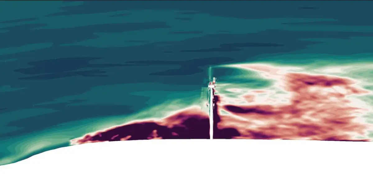
Planning and operating wind turbines in hilly and complex terrain is a challenge. Wind conditions in these areas are often difficult to predict, and conventional simulation models used to plan the optimal wind farm design occasionally reach their limits. This is precisely where the WINSENT Benchmark comes in—an international project that, in collaboration with partners worldwide, is advancing the accuracy of wind energy models.
Background: IEA Wind TCP Task 57 “JAM”
As part of the international IEA Wind TCP Task 57 “Joint Assessment of Models for Wind Energy” (JAM), industry representatives, research institutions, wind turbine manufacturers, and project developers from around the world exchange information. The goal is to validate numerical models for flow and turbine simulations using processed measurement and topography data from various global locations. The results are directly incorporated into improved planning tools that make it easier for wind farm developers to utilize sites for onshore wind energy that were previously difficult to develop. These tools also allow for even more precise determination of the mechanical loads on the turbines than before, thereby improving the engineering and design process for next-generation wind turbines.
Why the WINSENT Test Site?
The ZSW’s WINSENT research test site in Stötten in the Swabian Alb is ideally suited for this purpose. Its location in complex, mountainous terrain, combined with two research wind turbines (FWEA) and several meteorological measurement towers, provides a unique data set.
As the “Benchmark Lead,” the ZSW is responsible for coordinating with the international task participants and the Operating Agent. In addition to providing the measurement data, the ZSW also supplies the OpenFAST aeroelastic model of the FWEAs. Esslingen University of Applied Sciences, a partner in the WindForS cluster, provides the terrain data for various radii around the test site and evaluates the simulation results submitted by the international partners.
How the Benchmark Works
The comparison is divided into two clearly structured phases:
Phase 1: Simulation of the wind flow from the valley to the plateau. The inflow data for this come from a lidar system in the valley, while the reference data come from meteorological masts on the plateau, which is 160 meters higher.
Phase 2: Simulation of the additional flow conditions and the mechanical loads on the research wind turbines on the plateau.
Both phases are simulated under two conditions: with a high and a low leaf area index (LAI). Simply put: The simulations examine how the flow changes depending on whether the Albtrauf west of the test site is in a leafy or leafless state. This difference has a noticeable impact on flow conditions and, consequently, on the mechanical stress and operation of the turbines.
What does this mean for future work at the WINSENT test site?
The benchmark comprehensively validates the OpenFAST model of the two research wind turbines—an important step for the Open Science initiative as part of the WINSENT project and for the widespread, transparent use of the aeroelastic system model in science and industry in future research projects.
In addition, the close collaboration with the U.S. research institute NLR—which coordinates the JAM Task as the operating agent and participates in the WINSENT benchmark—could open up new opportunities for cooperation. After all, OpenFAST was originally developed at NLR.
Conclusion
The WINSENT Benchmark supports the improvement and further development of various software codes for flow and plant simulation, which are used by researchers, project developers, and wind turbine manufacturers alike.
Open data sharing and international collaboration not only lead to new connections but also result in improved tools that benefit not only research but also practical applications.